
Date/time
Date(s) - 01/01/2024 - 31/12/2025
All day
Project type
Selected participants
Kick off meeting in Beltinci
From 27th to 29th of May the RurAll consortium met in Beltinci for the first live event. We spent three days getting to finally know each other in person, debate about common issues, and brainstorm on many topics regarding our RurAll project. In organized workshops, we discussed the procedure of transnational cooperation in developing the governance model but also debated the challenges of community engagement in rural communities.


What we acomplished in 2024
During 2024 Community engagement methodology and collection of approaches was created. ADEL participated in in person workshop in Sarvar, where the community engagement strategies were discussed and further materials/tools were introduced in order to equip the partners with all tools necessary in order to conduct on site workshops during 2025. With the tools from COmmunity engagement plan, we will conduct workshops in Jelšava and engage general public in selection of the buildings most suitable for renovation.
The most important activity of 2024 was mapping of the empty and deteriorating buildings in municipality of Jelšava. We closely collaborated with experts (representatives of the municipality and local architect) from our ASP municipality, creating the excel document- data set, where we collected data for 59 buildings. We conducted on site selection of the suitable objects for mapping and mapping activity in Jelšava municipality after preliminary discussion with ASP (final selection of the buildings for renovation will be made by citizens during community engagement activities). For mapping activity we collected the data from the municipality office, on site research and in person visit of the buildings, desk research as well as collection of the data from variety of different offices, having specialised maps in Slovakia ( e.g. map of flood areas, protected natural areas in Slovak Office for Geodesy, Cartography and Cadaster, Map of heritage protection area- Slovak Heritage protection institute etc.). Based on this data we created an excel document which will serve as a base for creation of the GIS map. We created a large data collection of all the buildings located on the town square in the heritage protection area which serves to provide a clear overview of the state of buildings in the selected area. This database will serve for further selection of the buildings.
Meeting in Sárvár


We participated on in person meeting in Sárvár in Hungary (26.-28.11. 2024) together with the representatives of municipality of Jelšava, where variety of workshops took place (regarding mapping activity, business plans for renovation of the buildings, community engagement etc.)
We have regularly communicated with our ASP and organised 2 in person meetings in Jelšava discussing the mapping activity and preparation of community engagement activities in 2025


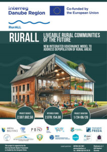
RurALL addresses the major challenge of depopulation in rural areas that is considered as one of most universal challenges of Danube area. Consequently, rural areas are facing lack of highly educated labour force and economic competitiveness, increasing ageing population, low accessibility and reducing quality of public services. Rural communities have insufficient resources and capacities to design and initiate an effective policy response for such a comprehensive challenge therefore we are going to develop a multi-stakeholder governance model. We are going to implement a crosssectoral and interdisciplinary approach that is going to be supported by intense community engagement activities and we will present deteriorating dwellings as a tool and potential for addressing the challenge.
It is our main objective to develop a governance model on addressing depopulation in rural areas by improving planning, management, and decision making/collaborative capacities of rural communities in exploiting the potential of deteriorating dwellings. The project is inspired by the New European Bauhaus initiative and will result in a transnational governance model for exploitation of deteriorating dwellings and will bring together a critical mass of international experts, policy-makers and citizens, intense knowledge exchange/generation, pooling of ideas and resources, uptake of good practises
and innovative/improved solutions. Rural communities will strengthen their governance and institutional capacities.
The project joins local/regional public authorities, research and business organisations and NGOs from 11 countries (14 partners + 7 AP). The consortium will develop 2 actions plans (governance model framework, community engagement plan) and deliver 4 pilot actions (mapping of the dwellings, ideas for dwellings functions, dwellings renovation ideas and business models for financing renovation) while creating the multi-stakeholder governance model.
Project is co-funded by the European union.
![]()
